Overview
Meshing for a compound flood simulation can be very challenging. It is crucial to accurately and economically resolve the small rivers in the watershed to ensure hydraulic connectivity while minimizing the mesh size. Additionally, flood risk reduction structures such as levees and dams also need to be represented in the mesh.
The mesh of STOFS3D has gone through major upgrades from STOFS3D v4 to v6, which serves as a good illustration of different meshing techniques:
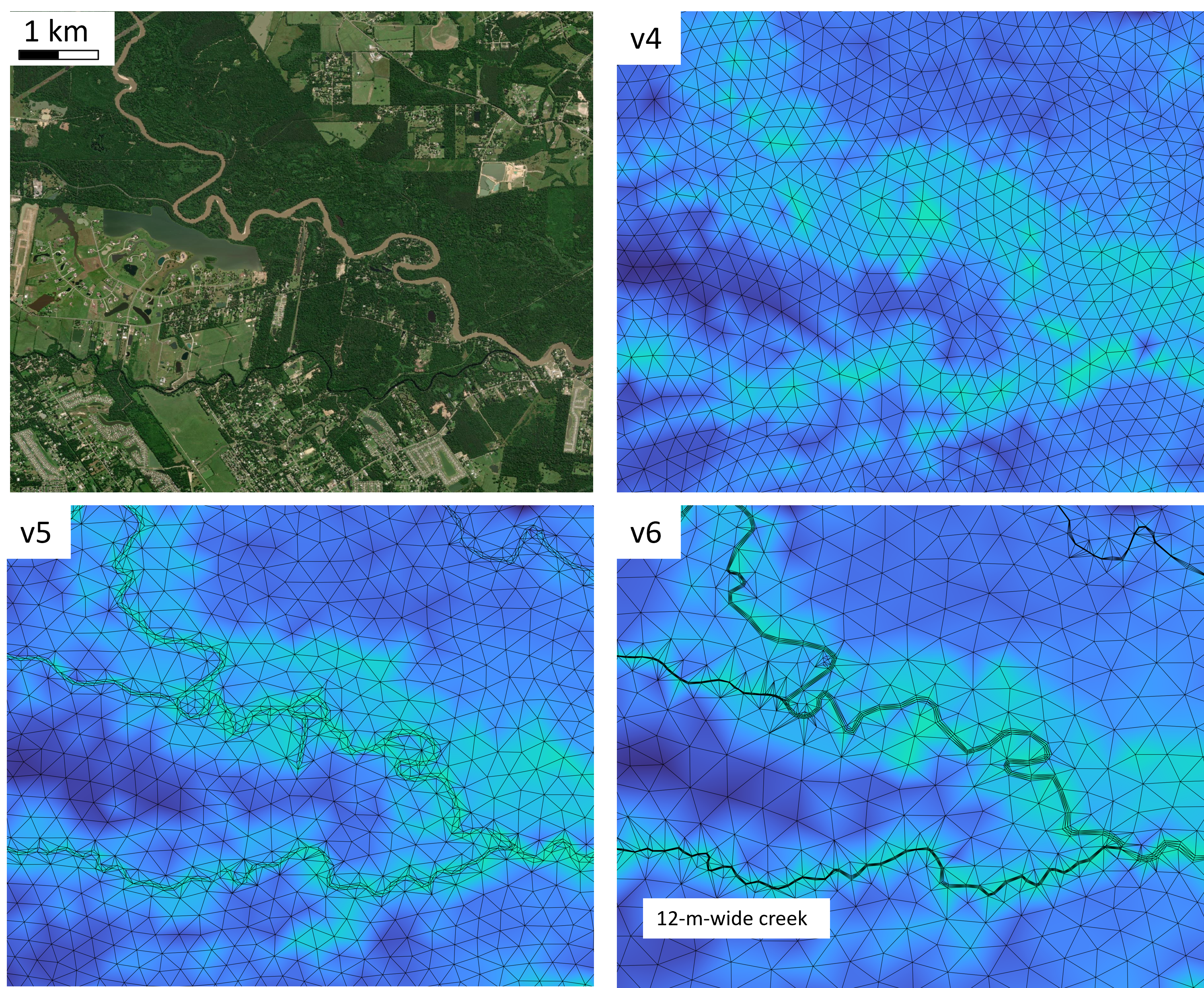
In the v4 mesh, small watershed rivers are resolved by a 1D representation, using 1D river segments from the National Water Model as feature arcs to guide the meshing.
In the v5 mesh, characteristic contours of the DEM are extracted and used to represent river banks and thalwegs. However, extensive manual cleaning is required due to the potential messiness of these contours.
In the v6 mesh, the river arcs are automatically generated by using
pyDEM and
RiverMapper,
both of which are included in SCHISM's GitHub repo.
Here is another sample v6 mesh that is zoomed in on the complex river network in South Carolina:
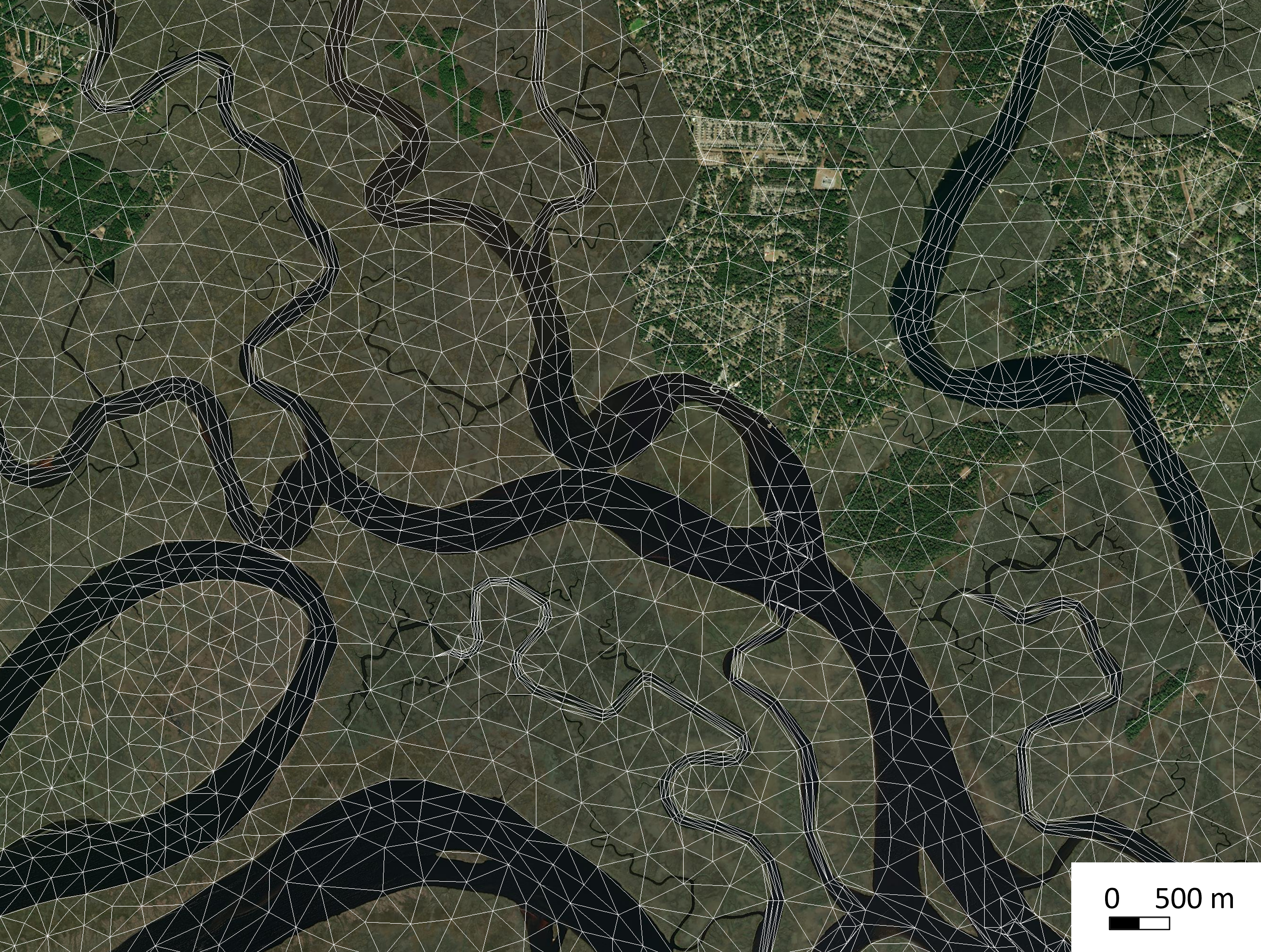
The meshing procedure used in v6 is preferred due to its minimal need for manual labor and its ability to produce the best mesh quality out of the three versions. The procedure includes three steps:
Publication
A parallel Python-based tool for meshing watershed rivers at continental scale